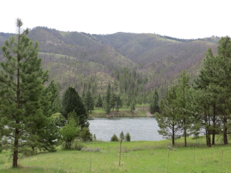
A meadow along the Missouri River, part of the Lewis and Clark National Historic Trail.
Over 4,000 miles of land and water routes today offer visitors an unforgettable vantage point of the West that most people never see. (Learn more about the trail at www.nps.gov/lecl)
We interviewed Janet Moreland, an intrepid adventurer who retraced a large portion of the journey of Lewis and Clark by kayak — 2,600 miles down the Missouri River and beyond.

Janet on the Jefferson River in Montana. Photo by Norman Miller
Congratulations on completing the Missouri River section of the Lewis & Clark National Historical Trail on your kayak. You retraced their homeward journey from where they’d stored their canoes and supplies (now Clark’s Reservoir) and also explored upstream from there on skis and bicycle. What led you to undertake this historic journey?
How long did the trip take you and how many hours did you paddle most days?
I began on April 24, 2013, and reached the Gulf of Mexico on December 5, 2013. I believe someone totalled the days at 223. I averaged six to eight hours of paddling a day. The wind was the final say on when and how long I paddled. I did not rush myself like most male expedition paddlers. I wanted to savor the experience so I wouldn’t be slave to the thought afterwards that I should have taken more time here or there. That said, there was not a lot of time for exploratory trips. I stayed on the river for the most part.
I carried three to four weeks of food in my kayak. I was never in a situation where I could not survive without stopping at a store. On a few occasions I picked up a box mailed to me at a certain town I was approaching where the post office was easily accessible. This package mainly contained dehydrated vegetables and jerky from home that I supplemented into my pasta and rice dinners. There might be some dark chocolate in the box, too, for a treat! Finding a campsite could be difficult if I waited until dark. Some element of thinking ahead was necessary. Most of the time I did not know where exactly I would be camping. I tried to find a campsite before the sun set on the horizon, for it was then I would know that I had roughly one hour of sufficient light left to set up camp.
Do you have any favorite Lewis and Clark sites?
What were some of the challenges along the way?
After the great accomplishment of arriving back to St. Louis (where Lewis and Clark completed their journey) you then continued all the way to the Gulf of Mexico. When did you decide to add this segment to your trip and how did it compare to the Missouri?
I am the third person to ever paddle from the ultimate source of the Missouri River to St. Louis and then on to the Gulf of Mexico. Mark Kalch, an Australian, and Rod Wellington, a Canadian, both completed the trip the year prior to my journey. This makes me the first American as well as first woman to do this trek solo. Once I decided to paddle the Missouri, I next had to decide whether to start at the source, or whether I could start at the source at 10,000′ in elevation. Once the decision was made to go source-to-sea, I planned on the St. Louis to Gulf leg for the next summer (2014). Once I realized I would not be teaching with a contract in 2013, it made more sense to continue on while I had the momentum and support, and then actively job search in the summer of 2014.
I knew nothing about the Mississippi River when I started down the river. I did have experienced paddlers as a resource and guide for the first few days. I was connected to the river angels network all along the river so I was always able to get information if needed. Once alone on the river however, I fell in love with the Mississippi and enjoyed the sandbars, tow and barges, wildlife and solitude. Plus, there was minimal mud, which came as a pleasant surprise. The size of the Mississippi surpasses the Missouri for the most part, but an intimate relationship with the river is still possible, like with the Missouri. The barge and ship traffic is intensified on the Mississippi, but I loved having their company. I believe the tow captains of today would be navigating the steamships of old had they been born in that era. I found the tow and barges to be a romantic part of the Mississippi experience. Because of its size, the Mississippi has a rocking sensation to it, which gives it breath and life, so to speak.
Follow more details of Janet’s epic journey and see more pictures at http://www.loveyourbigmuddy.com/